Soil Investigation and Geotechnics
The design and construction of earthquake-resistant structures depends on the correct analysis of the structure-soil interaction and dynamic behavior and the selection of design parameters within this framework. For this;
- Building and Building type structures,
- Bridge, Viaduct, Road routes,
- Tunnel Projects,
- Factories, Mass Housing areas
- Nuclear Power Plant, Dam etc.
We are carrying out survey studies for the detailed examination of the area that is planned to be built during the project design phase of the above-mentioned structures..
Soil - Geotechnical study program is created by our expert teams depending on the project requirements. In the field of work with an optimum solution-oriented approach;
- Fill or vegetable soil thickness,
- Soil layer thicknesses,
- Consistency and strength properties of soils,
- Groundwater level,
- Dynamic Properties of Soil,
- Ground settlement, Swelling potential,
- Bearing capacity problems, bearing capacity of the determined layers, bedding coefficients,
- Liquefaction potential of the soil,
- Slope stability problems in foundation excavations or sloping areas,
- Excavation support systems,
- Rock quality calculations in rock formations RMR, Q classifications,
- Earthquake risk potential of the project area, the largest possible earthquakes and acceleration values, selection of spectrum coefficients,
- Whether there are active faults in the project area or its distance from active faults,
- Presence of ground conditions that may cause different settlements at the foundation level,
It is aimed to obtain and examine the technical information that will meet the requirements of the project, such as the titles given above..
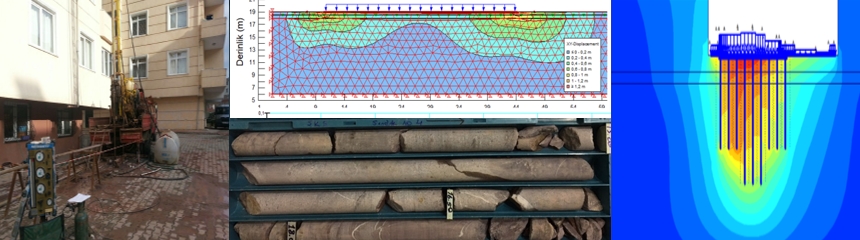
In Soil - Geotechnical Survey studies, after revealing the underground structure and dynamic properties in 2D and 3D with detailed geophysical studies, we conduct lithological identification and on-site tests by making a drilling program. With the correlation of the drilling data and the geophysical results, the area where the structure will be built is modeled and examined in 3D. Thus, it is tried to minimize the different conditions related to the ground that may be overlooked and that may arise during excavation..